Mount Rainier National Park centers on the mountain, but has much to offer
written by Ethan Shaw
Mount Rainier — also known by the regional indigenous name Tahoma — is not only one of the defining landmarks of the Pacific Northwest, it’s a glacier-clad colossus that’s among the most topographically prominent peaks on the continent. This is the 14,411-foot high point of the Cascade Range—garbed in more ice than the rest of the range put together—and the centerpiece of the fifth national park established in the U.S., back in 1899.
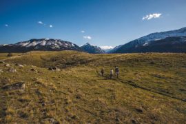
The bulk of “the Mountain” and the roughly square shape of the national park divide visitor access into four quadrants—northwest, southwest, southeast, northeast. You could spend a summer weekend circumambulating Rainier by car and savoring up close the distinct looks of each of its four faces, but that’s an awful lot of driving and not as much time simply immersing yourself in this royal Cascadian kingdom. Our three-day itinerary does skip one of the park’s magic places—the Carbon River, the wettest Rainier drainage and host to a superb example of a Northwest temperate rainforest. It won’t be as ambitious as the nearly 100-mile backpack around the volcano on the Wonderland Trail, or a climb to the summit itself—one of America’s mountaineering classics.
This trip, however, will introduce you to the mega-scale scenery of Mount Rainier National Park, a bit of its history, and—most important—a sense for the monolithic presence of this kingly snowpeak: palpable enough when seen from Puget Sound vantages, but almost stupefying right in its shadow.
DAY 1
RUSTIC LANDMARKS • WATERFALLS
From Tacoma or Olympia, reach Rainier via 706 up the Nisqually River, the classic approach from the park’s early days. As you head up to Longmire, study the river channel for evidence of the occasional lahars and outburst floods that have barreled through off the volcano. An epic 2006 deluge washed out the Sunshine Point Campground that once stood near the Nisqually Entrance, and the Kautz Creek pulloff shows the work of a massive 1947 mudflow that temporarily dammed the Nisqually.
Stop at Longmire to delve into the park’s story. This visitor hub—the original park headquarters—is named for James Longmire, who came across mineral springs in these soggy meadows in 1883 and opened the Longmire Medical Springs Resort here shortly thereafter. You can see those springs and associated travertine mounds along the short, easy Trail of the Shadows. The path also allows more ambitious hikers access to the route up Rampart Ridge, a steep crest—edifice of a Rainier lava flow several hundred thousand years old. It walls the north side of the Nisqually Valley and serves up awesome views.
Admire the complex’s vintage buildings on the self-guided Longmire Historic District walking tour. Featuring native stone and timber, structures such as the administration building set the standard for the National Park Service Rustic Style, a movement that defined the architecture of U.S. national parks in the early twentieth century.
Other Longmire landmarks include the long-standing National Park Inn—which includes a restaurant, if you’re hankering for lunch—and the Longmire General Store, a good place to grab picnic and camping grub, if you haven’t already stocked up.
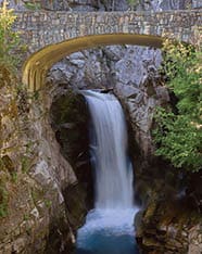
Then—onward to Paradise! En route, check out Christine and Narada falls and the lava-rock headland of Ricksetter Point, and sneak peeks at Mount Rainier and the Tatoosh Range, an arresting cluster of dark, jagged peaks just south of the volcano.
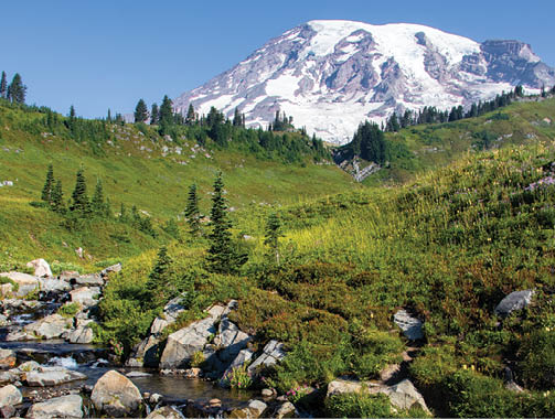
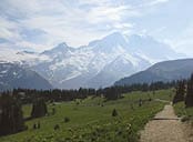
Reach Paradise (elevation 5,400 feet), the most popular destination in the park. With the Tatoosh jags shredding the southern horizon and the immensity of Tahoma or its cloud cap to the north, and timberline meadows smoldering with summer wildflowers, the place comes by its name naturally.
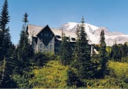
Make another Rainier architectural icon home for the night. The Paradise Inn opened in 1917, a couple of years after the celebrated “Road to Paradise” was finished. Anchored by a yawning Great Room and displaying beams salvaged from yellow-cedar snags near Narada Falls, this mountainside hotel stands as a worthy counterpart to Western lodges such as Yellowstone’s Old Faithful Inn, the Crater Lake Lodge and Lake Quinault Lodge on the Olympic Peninsula.
To cap off your inaugural day under Tahoma’s icy gaze, try a Rainier burger or some bourbon buffalo meatloaf, a slice of pie, and a boozy “Kautz mudflow” or “glacier coffee” digestif in the Paradise Inn’s dining room.
DAY 2
PARADISE • GROVE OF THE PATRIARCHS
Breakfast at the inn should suffice for the day’s meadow meandering and glacier gazing, the itinerary for a morning in Paradise. The area has an extensive trail network and, given the expansive scenery, there’s no bad choice. The classic overview walkabout is the Skyline Trail, a 5.5-mile loop you can hook into right from the hotel. Along with marmots, you might be rubbing shoulders with climbers beelining for Camp Muir, one of the main starting points for summit attempts and also its own turnaround destination for strong hikers.
Depending on your timing and the weather, you’ll see exuberant blooms in Paradise Park’s subalpine gardens, from lupines and paintbrushes to torch-like beargrass and shaggy pasqueflower. Take the short detour to Glacier Vista, where you’ll encounter the much-studied Nisqually Glacier.

The Skyline Trail culminates in Panorama Point, where, in clear conditions, your view includes several of Tahoma’s fellow fire-mountains—bulky Mount Adams, lopped-off Mount St. Helens, toothy Mount Hood—as well as the ripsaw Tatoosh rampart and, beyond, the pale Goat Rocks, ice-gutted remnants of a onetime Rainier-esque stratovolcano.
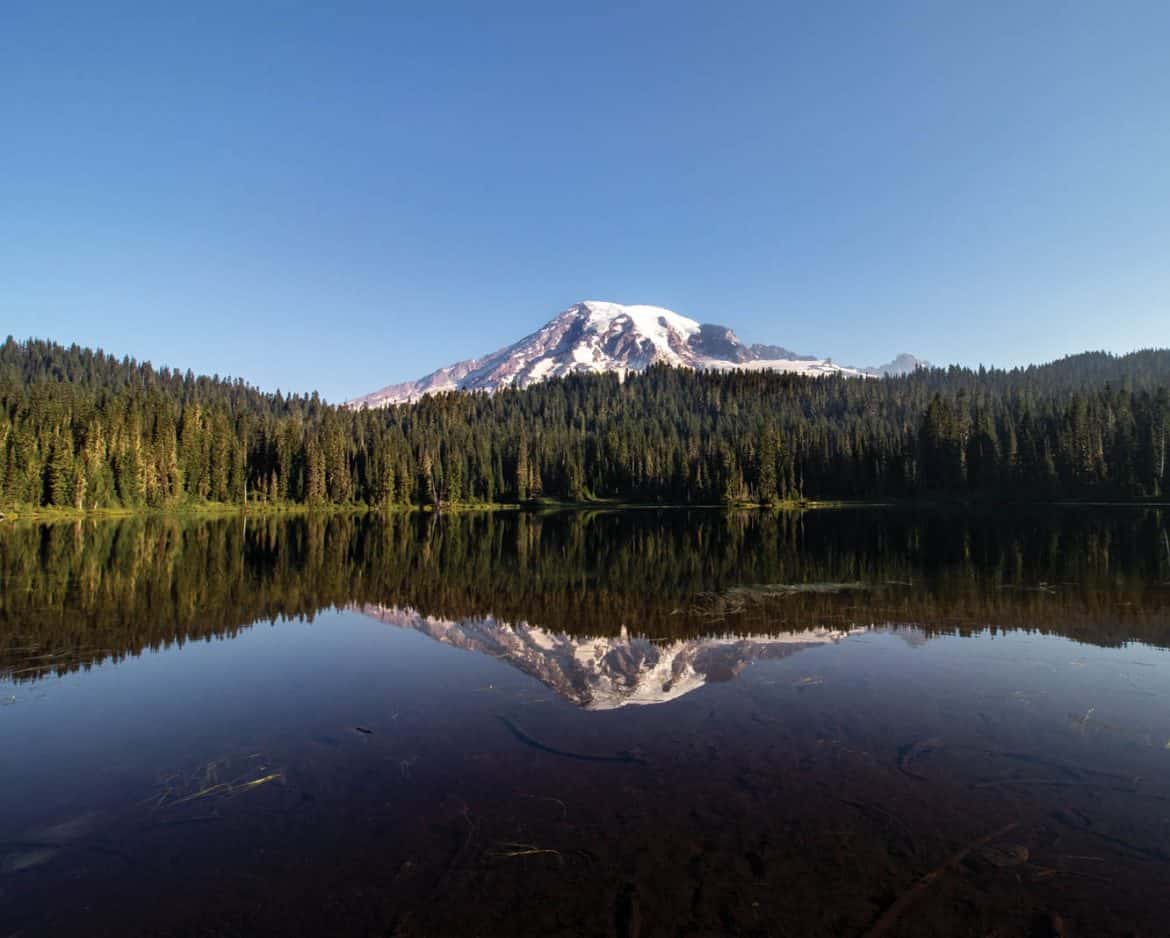
When you can tear yourself from Paradise, saddle up for your afternoon journey to the park’s southeast. Between the Paradise River valley and Stevens Canyon, you’ll pass one of the popular Rainier photo ops at the Reflection Lakes. Farther east, peer into the Box Canyon of the Muddy Fork Cowlitz River, a tight-cleft gorge up to 180 feet deep and as narrow as a few feet across.
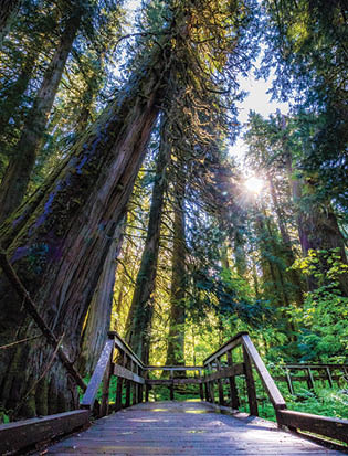
Before heading for a campsite at the Ohanapecosh Campground, pay your respects to the old-growth giants at the Grove of the Patriarchs, explored along an easy, mile-long interpretive path. The dimensions of the western redcedar and Douglas firs in this river-bottom forest—some of which likely exceed a millennium in age—are staggering.
DAY 3
FLOWER FIELDS • VIEWS
Your last day in Tahoma’s company calls for early rising so you can appreciate the splendor of Sunrise—the highest vehicle access in the park—at its morning prime. The east route takes you north up the Ohanapecosh—which, like the Muddy Fork, drains via the Cowlitz to the Columbia River, unlike the other major Rainier drainages that send glacial meltwater to Puget Sound—and then west up the White River. Along the switchbacks climbing Sunrise Ridge, pause to take in the vista from Sunrise Point, which includes Rainier and Adams and highlights the impressive relief of the White River’s glacial trough.
Sunrise (elevation 6,400 feet) is home to a visitor center with fine exhibits as well as a day lodge, and presents Rainier’s northeast face in showstopper fashion. The view is great from the parking lot, but expands gloriously from the easy Sourdough Ridge Trail looping through the flower meadows and conifer groves above the grounds. Feast your eyes on the smooth snow dome of Columbia Crest—the ultimate summit of three-headed Tahoma—and the craggy buttress of Little Tahoma, a remnant of the volcano’s former east flank. You can also see where a spectacular east-face collapse, the Osceola Mudflow, triggered some 5,600 years ago.
In between Little Tahoma and Steamboat Prow, the Emmons Glacier—biggest by area in the lower forty-eight—sparkles down to the White River valley far below. Southward rise the fangs of the Cowlitz Chimneys and the Goat Rocks behind. Far in the southeast distance Mount Aix and Bismarck Peak make twin pyramids. From the crest of Sourdough Ridge, the view north and northwest unfurls dramatically to a sharp-crested North Cascade skyline, including, if it’s clear, the white monsters of Mount Baker and Glacier Peak.
When the trip home calls you down from Sunrise, you’ll be in the proper state of mind for leaving this old and venerable park—stunned by her beauty and charm.
EAT
National Park Inn Dining Room
www.mtrainierguestservices.com/rainier-dining/national-park-inn-dining-room
Paradise Inn Dining Room
www.mtrainierguestservices.com/rainier-dining/paradise-inn-dining-room
Paradise Camp Deli
www.mtrainierguestservices.com/rainier-dining/paradise-camp-deli
Sunrise Day Lodge
www.mtrainierguestservices.com/rainier-dining/sunrise-day-lodge
The Highlander
Mt. Rainier Railroad Dining Co.
STAY
National Park Inn
www.mtrainierguestservices.com/accommodations/national-park-inn
Paradise Inn
www.mtrainierguestservices.com/accommodations/paradise-inn
Mount Rainier National Park campgrounds (Ohanapecosh, Cougar Rock, White River, Mowich Lake)
www.nps.gov/mora/planyourvisit/campgrounds.htm
Silver Springs Campground
www.bit.ly/silverspringscampground
Gateway Inn
Alexander’s Lodge at Mount Rainier
PLAY
Tatoosh Wilderness
Norse Peak Wilderness
William O. Douglas Wilderness
www.wilderness.net
Mt. Rainier Railroad & Logging Museum
Northwest Trek Wildlife Park
Alder Lake Park
www.mytpu.org/community-environment/parks-recreation/alder-lake-park